Aster research spire
A 620 m three-part research tower with projecting laboratory decks, an observation ring, antenna crown, elevated specimen gardens and an open public science court.
X 1520 / Z -1160 · +330 m ground · 620 m structureTHE ETHER / WORLD DESIGN / BUILD STUDY 03
A city above the canopy.
A world rooted in the land.
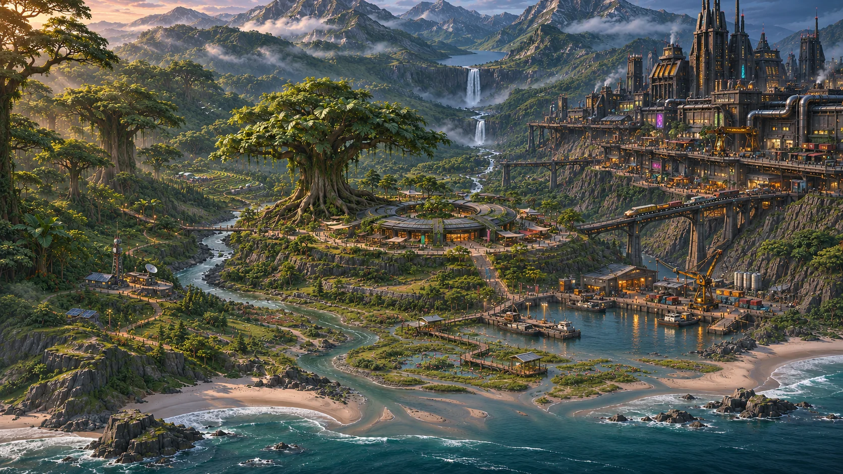
THE LAYOUT DECISION
The first region is a coastal watershed on a larger lush planet. Crown mountains feed Veilfall gorge, then a river flows west of Confluence hub and south into the ocean. Titanwood occupies the western foothills; Strata city rises from the eastern bedrock ridge. The hub sits on a dry terrace between these landscapes.
The current playable world is a small waterfront study. Its station, workshop, observatory, lamps and pavilion establish an architectural language. This proposal gives them a larger home; the new regional coordinates do not move the current scene. Build study 03 expands Strata into a continuous city, adds four tributaries and new hills, and constructs a research spire, skyport, carrier docking station and smaller exploration landmarks.
01 / MEASURED GEOGRAPHY
North = −Z · east = +X · metres · Y-up
Sea level = 0 m · elevations are design targets
02 / THREE DIMENSIONAL LAYOUT
Orbit to compare height and spacing.
Inspect a landmark, or use Street view and Free fly.
Loading the planning model…
DISTRICT INSPECTOR
X 0 · Z 0 · +42 m
A 220 m civic terrace above the floodplain. Open center, circular promenade, four clear exits. Threshold becomes the transit hall on the southern edge.
Detailed planning geometry: branching canopy, rock formations, industrial facades, utility works and a freight viaduct. This is a design study; final game assets remain a later production step.
BUILD STUDY 03 / EXPLORATION LANDMARKS
A 620 m three-part research tower with projecting laboratory decks, an observation ring, antenna crown, elevated specimen gardens and an open public science court.
X 1520 / Z -1160 · +330 m ground · 620 m structureA large passenger terminal and hangar complex with three marked landing pads, approach beacons, docked shuttles, service vehicles and elevated passenger bridges.
X 2110 / Z 180 · +145 m ground · 58 m structureA giant surface docking interchange: a 420 m terminal spine, three carrier berths, gantry frames, moored cargo vessels and a freight link descending to the harbor.
X 1650 / Z 1130 · +150 m ground · 115 m structureBroken stone archive walls, a buried chamber mouth, a cliff stair and a lookout above the tributary gorge. The trail crosses water on a real bridge.
X -570 / Z -1090 · +195 m ground · 32 m structureA weathered coastal signal tower, rotating-dish silhouette, service cabin and ocean-facing observation platform on the western headland.
X -1660 / Z 1390 · +42 m ground · 65 m structureA cantilevered valley overlook reached by a winding ridge trail, with a small shelter and views toward the creek bridges and city skyline.
X -640 / Z 280 · +135 m ground · 18 m structureThe landmark meshes are built into the 3D scene, including carrier hulls, gantry frames, landing-pad markings, laboratory rings, piers and terminal facades. Street view begins on the public city spine. Free fly uses WASD, Q/E for height, Shift for speed and drag to look; it is a review camera rather than the character controller.
WATERSHED / FIVE CONNECTED CHANNELS
14 surveyed water levels · upstream +390 m → downstream +0 m
5 surveyed water levels · upstream +265 m → downstream +65 m
5 surveyed water levels · upstream +118 m → downstream +8 m
7 surveyed water levels · upstream +310 m → downstream +3 m
4 surveyed water levels · upstream +330 m → downstream +133 m
Titanwood cascade, Rootwater creek, Strata east run and Crown research gorge meet the main river at matching positions and levels. The shared terrain is carved around each branch. Hills and ridges separate the catchments; new bridge piers support existing trails across the cut valleys.
STRATA / INDUSTRIAL CITY DIRECTION
The city now follows the supplied references: dark mechanically crowned towers, tightly stacked shop streets, exposed ducts and cable trays, ribbed steel, service bridges, freight courts and localized neon. Keep the giant forest and river valley lush; the industrial density belongs on the eastern ridge. The central Canopy Exchange remains the greener gateway to this heavier urban district.
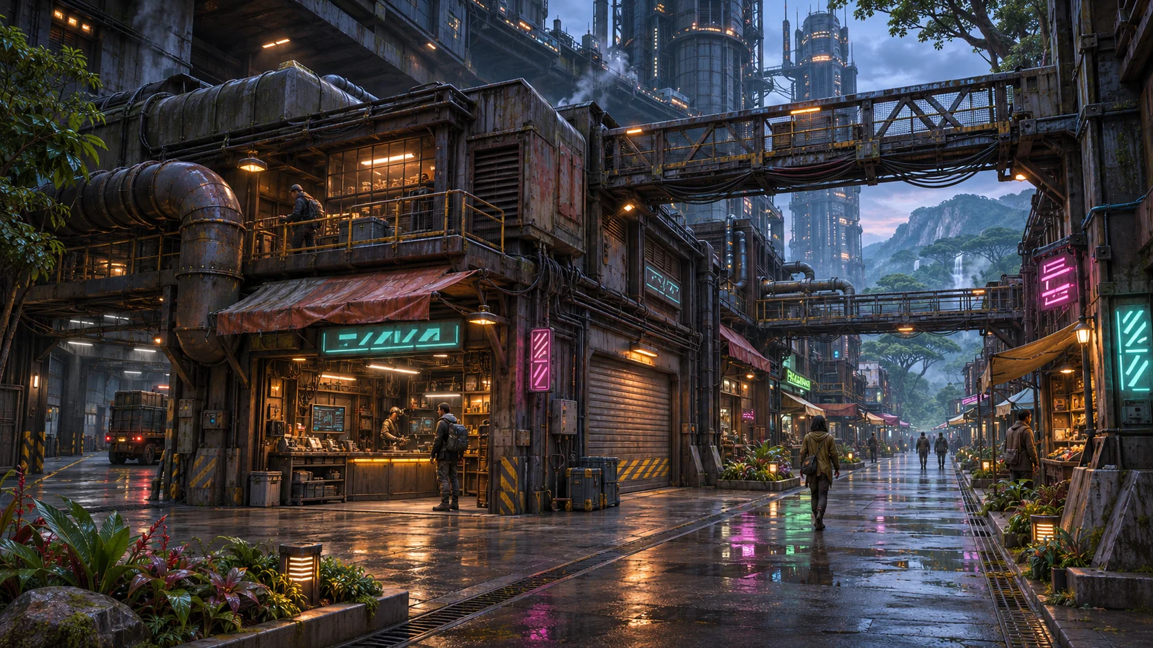
Low, densely stacked repair shops and food counters under the city decks. 5 m public lanes, 3 m covered frontage, recessed shutters, freight behind the shops. Rusted steel, neon and amber work lamps.
X 830 / Z -245 · 520 × 440 m envelopeMachining halls, gantry cranes, loading courts and enclosed filter plants. Parallel utility trunks feed the blocks; no industrial outlet discharges into the river.
X 1310 / Z -295 · 640 × 500 m envelopeAn irregular skyline of 80–260 m towers with stepped bases, mechanical crowns, fins and sparse lit window bands. Mid-level service bridges connect the blocks; supports continue to bedrock.
X 1110 / Z -730 · 720 × 560 m envelopeDense mixed-use mid-rise blocks connect the tower crown, fabrication courts and lower market into one urban fabric. Roof utilities, residential windows, service alleys and planted pocket courts give the city a daily rhythm.
X 1055 / Z -480 · 840 × 600 m envelopeAn eastern logistics yard for containers, cranes and freight transfer. The elevated line runs south to the harbor; pedestrian crossings use dedicated bridges and lifts.
X 1590 / Z -20 · 480 × 380 m envelopeDistrict energy, enclosed heat exchangers, storage tanks and a maintenance court. Place mechanical noise and service traffic on the eastern ridge, away from the elder grove and river.
X 1530 / Z -655 · 440 × 350 m envelopeSmall cultivated strips and greenhouses occupy the sunny lower eastern slope. Contour beds, retaining walls and planted swales connect the city fringe to the estuary landscape.
X 720 / Z 740 · 520 × 460 m envelopeA secondary skyline of stepped and cylindrical towers above the western approach, linked by elevated service walks and an open canyon vista.
X 600 / Z -780 · 500 × 480 m envelopeDense laboratory and residential towers surround the research spire, with roof gardens, equipment crowns and public science terraces.
X 1720 / Z -970 · 560 × 520 m envelopeA dense lower city of covered alleys, repair courts, stepped housing and bridge approaches. Public streets connect the hub to the skyport district.
X 730 / Z 110 · 600 × 440 m envelopeLarge assembly halls and gantry yards feed the giant docking station. Freight stays on the service spine; visitor promenades overlook the assembly berths.
X 1780 / Z 690 · 570 × 480 m envelope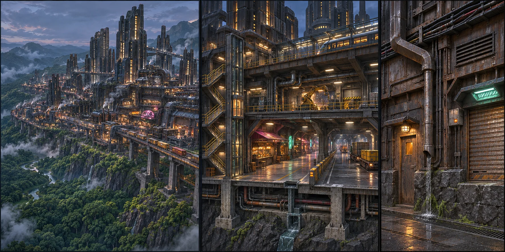
VALLEY / SMALLER DESTINATIONS
A small raised field shelter in a forest glade, with a boardwalk spur and independent root-safe footings.
X -1100 / Z 120A ring of ancient roots, stratified stones and low lanterns. The clearing is visible through clustered trunks rather than a uniform tree grid.
X -1580 / Z -520Reed islands, silt shelves and deadwood in sheltered shallows. The boardwalk sits above the wet ground; the river mouth remains open.
X -480 / Z 1230A planted rainwater-treatment garden for the arrival district. Settling beds and contained channels make the hub drainage visible.
X 270 / Z 300A modest stone-and-metal rest shelter behind the dunes, sheltered from salt spray and separate from the industrial harbor.
X 1060 / Z 1530Three branching canopy species form irregular habitat patches across both sides of the valley, thinning at exposed ridges and the coast. Low understory fills sheltered soil pockets. Rock clusters share a formation direction; gravel and reeds follow the river margins. Cultivated terraces and smaller shelters connect the larger districts without paving over the landscape.
03 / CONFLUENCE HUB
220 m terrace · 110 m elder tree
6 m main avenue · 4–5 m secondary paths
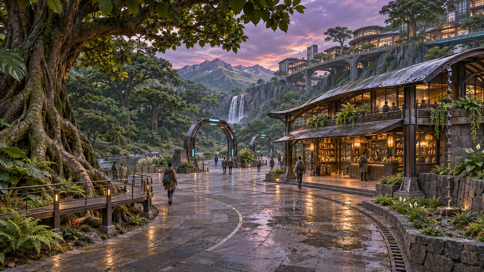
The elder tree anchors the west shoulder, with a 25 m root reserve. Four portals sit around the plaza, clear of roots, queues and the main sightline. Shop and workshop sit east, close to the city service approach. The southern avenue frames the tree and distant mountains.
An 18 × 12 m ground floor contains a visible counter, equipment displays, a workroom and back-of-house storage. A partial upper mezzanine holds the resident workshop office; a small lift accompanies the stair. A 3 m covered frontage keeps queues off the plaza. One material family connects shop, portal plinths and city.
Rain canopy → gutter → chain → bioswale. Bedrock → footing → ceramic wall. No primary support attaches to the elder tree. An accessible entrance meets the plaza level with a flush drained threshold.
04 / DISTRICT SCHEDULE
| Place | X / Z (m) | Elevation | Purpose / environmental fit |
|---|---|---|---|
| PHASE 1 | 0 / 0 | +42 m | A 220 m civic terrace above the floodplain. Open center, circular promenade, four clear exits. Threshold becomes the transit hall on the southern edge. |
| PHASE 1 | 75 / 5 | +42 m | 18 × 12 m shop east of the plaza, west-facing counter, 3 m accessible frontage. Ceramic rain canopy, warm interior, independent rock foundations and a southern rain garden. |
| PHASE 1 | -130 / -24 | +43 m | A 110 m landmark tree on the dry west shoulder of the hub. Protect a 25 m root zone outside the ring promenade. A small grated viewing spur may bridge roots; no shop footings or portal plinths within the reserve. |
| PHASE 1 | 0 / 140 | +38 m | Retain the original station identity as a southern gateway. A 6 m pedestrian approach opens toward the elder tree and northward mountain vista. |
| PHASE 1 | 135 / 95 | +44 m | Resident editing and crafting on the service side of the shop. Delivery access from the east; no freight through the plaza. |
| PHASE 1 | -110 / 285 | +14 m | A small inlet landing with an open water view, retaining the current promenade, lamps and pavilion language. Foundations extend to riverbed; planted banks stay visible. |
| PHASE 2 | -950 / -220 | +105 m | Western giant-tree forest. 70–140 m canopy, sparse 160 m elders; clusters follow soil and shelter. Fern pockets, fallen timber and stone glades give long views between trunks. |
| PHASE 2 | 1040 / -470 | +210 m | A dense industrial city on the eastern ridge: Underworks market, fabrication terraces, freight exchange, utility works and a tower crown. Weathered steel, exposed ducts and pipe galleries, supported service bridges, sparse warm windows and localized neon. Towers rise 80–260 m above their terraces. |
| PHASE 2 | 570 / -1060 | +320 m | A quiet ridge above the city approach, facing the mountain watershed. Retain the telescope and atlas; lift and long contour trail share the last ascent. |
| PHASE 2 | -310 / -1050 | +170 m | Two drops in one continuous drainage: 390→310 m upper falls, 300→170 m lower falls. A west-bank lookout stays outside the spray zone; pools discharge downstream. |
| PHASE 3 | 60 / -1870 | +740 m | Northern massif with peaks around 900 m and a lower headwater catchment. Scree follows gullies; sparse trees stop below the exposed upper ridge. |
| PHASE 2 | 390 / 1370 | +12 m | Sheltered east side of the river mouth. Raised docks and a service pier, with an open pedestrian edge. Beach dunes and tidal channels remain unbuilt. |
| PHASE 2 | 850 / 1670 | +4 m | Southern sandy crescent. Dunes behind dry sand, wet compact sand below the wrack line, rocky headlands at each end; ocean continues beyond the region. |
GEOLOGY / R1–R5
| Formation | X / Z (m) | Radius | Placement rule |
|---|---|---|---|
| R1 · Gorge jointed basalt | -350 / -1150 | 65 m | Cliff shelves frame the lower falls; loose fragments collect below the dry faces, away from the plunge pool. Shared joint direction: 25° east of north. |
| R2 · Titanwood glade | -1240 / 320 | 95 m | Broad mossy anchor stones interrupt the western forest. Trees occupy soil pockets, not the rock crowns. Shared joint direction: 25° east of north. |
| R3 · Strata ridge buttress | 740 / -430 | 80 m | Exposed structural rock below city decks. Footings seat into the continuous outcrop, with no unrelated boulders under columns. Shared joint direction: 40° east of north. |
| R4 · Western estuary bluff | -650 / 720 | 70 m | A rocky outer-bank backdrop, leaving the estuary channel and inner depositional banks open. Shared joint direction: 25° east of north. |
| R5 · Crescent headland | 1250 / 1580 | 100 m | A coherent coastal headland terminating the beach. Wet faces, pools and smaller fragments follow exposure and tides. Shared joint direction: 40° east of north. |
Each formation starts with one large anchor, then 3–8 asymmetric companions and small downslope fragments. Bury 20–40% of each loose rock. Reserve paths, root zones, doorways and the full river channel before placing detail. River stones follow local flow and bank erosion; beach stones cluster at the headlands.
05 / MOVEMENT
The hub has paired, two-way gates to Titanwood, Strata, Tidelight and the Crown shelter. Each far gate has a safe 4 m landing and a return to its corresponding hub gate. The Crown gate belongs to a later phase. Other continents and off-world destinations attach to the Threshold transit hall later, with named destinations and loading boundaries.
The Rootway spans the river on a real deck; the bank and flowing water continue underneath. Grades above 8% call for switchbacks, steps with an alternate accessible route, or a lift. The Crown ascent is explicitly a lift route. Path geometry and collision must share the same surveyed surface.
Lengths follow the proposed three-dimensional centerlines. Typical walking time at 1.4 m/s: 1 km ≈ 12 minutes; portals keep revisits practical.
06 / CONTACTS & TRANSITIONS
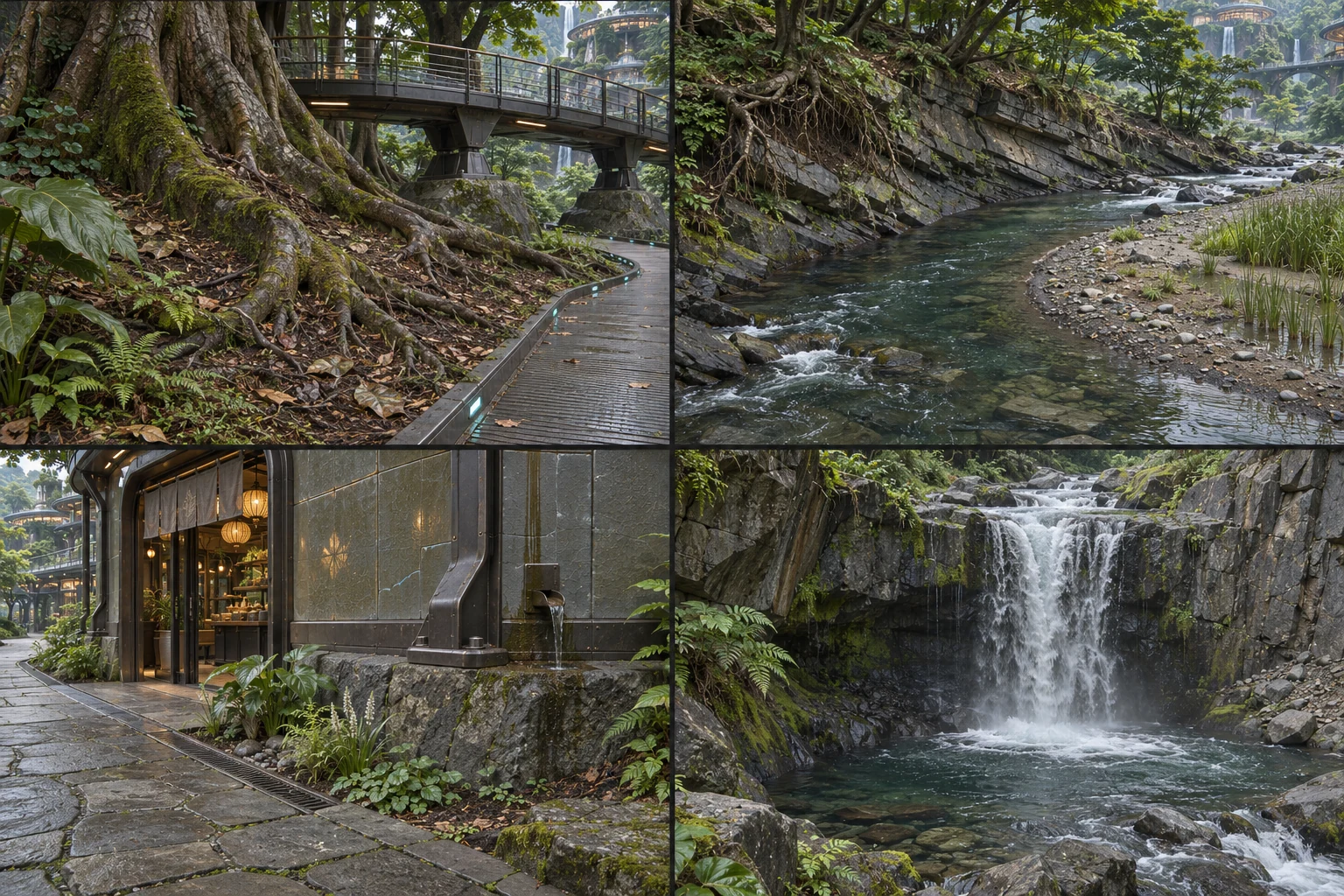
Root flare establishes the tree base. Bury fine roots, build a supported soil mound, then blend humus, litter, moss and understory. Protect the entire root silhouette and overhead clearance.
REJECT: Floating downhill roots, trunks in water, paving through buttress roots, identical evenly spaced trees.Use a shared bedding direction within each outcrop. Embed 20–40% of isolated boulders; group large anchor stones, fractured companions and downslope scree. Match color, normal and roughness at contact.
REJECT: Random upright pebbles, repeated silhouettes, rocks balancing on points, colliders narrower than visible rocks.Carve a bed before adding water. Outer bends erode; inner bends deposit. Use bed-depth color, an irregular wet band, shallow gravel and sheltered reeds. Foam follows velocity and impact.
REJECT: A blue plane over grass, vertical shore seams, foam everywhere, dry rock beneath a waterfall.Seat supports on footings extending below terrain. Use retaining walls where cut and fill meet slopes; add a drainage joint, localized damp stain and low plants at the soil edge. Keep entrances clear.
REJECT: Hovering feet, walls ending above slopes, buried doors, grass through floors, foliage used to conceal structural gaps.Reserve walking width plus 0.7 m shoulders. Align grade, visible surface and collision. Use bridges over water and roots, contour paths on hills and lifts for steep ascents.
REJECT: Trees in routes, invisible steps, navigation through roots, paved river dams, railings without continuous landings.A visible upstream channel feeds each lip. Connect falling sheet, plunge pool, impact foam, wet-rock zone, mist and downstream outflow. Bound spray to the impact area.
REJECT: Water spawning from rock, a pool with no outlet, mist hiding missing geometry, disconnected water elevations.07 / ASSET & MATERIAL BRIEF
Three giant-tree species with buttress, mid-trunk, canopy and deadwood variants; a basalt kit with shared bedding; eroded banks, gravel shelves and scree; river reaches, two waterfall lips and plunge pools; hub retaining walls, bridge decks, shop modules and portal plinths; ridge-supported city terraces, pylons and bridges.
Preserve original UVs, intentional silhouette and matching collision bounds. Hero meshes get three real geometry levels; distant trees use varied canopy clusters and billboards. Separate roots, terrain skirts and shore transitions so they can be fitted to the surveyed height field.
Matched base color, normal, roughness and height for bark, basalt, humus, gravel, sand, ceramic and metal. Use existing licensed photo maps for the first material pass; generated references guide art direction. New captured sets must keep source, license, scale and hashes together.
Start near assets at 2K and distance assets at 512–1K, then profile. Keep baked shadows out of base color. Use world-scale mapping on cliffs, localized wetness near water, directional moss and contact decals. Normal detail cannot replace root flares, rock strata or a believable bank silhouette.
08 / BUILD ORDER & ACCEPTANCE
Acceptance: no floating roots or supports; no submerged land trees; no blocked paths; no abrupt shoreline seams; no disconnected waterfalls; every enabled portal returns safely; visual and navigation surfaces agree. Contact patches improve transitions after structural placement is correct.